San José de Chiquitos

Bolivia

DATES: AUGUST 2015-NOVEMBER 2019  |  SATELLITE: SENTINEL 2  |  CATEGORY: LOGGING

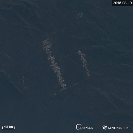
The logging of rainforests and tropical savannah is one of the main causes of the destruction of natural habitats in the jungle and is often the result of illegal activity. Satellites are a good tool to detect and quantify logging in the most inaccessible and remote areas of the planet.

San José de Chiquitos is a good example. Reports of illegal logging and subsequent trafficking of the wood are, unfortunately, commonplace in this Bolivian municipality located within the Department of Santa Cruz. The media have provided images to prove it: trucks loaded with wood emerging from the tropical forests prevalent in the region.

The climate in the tropical savannah causes the area vegetation to be formed by dense forests with enormous trees. The lack of surveillance and thick vegetation has caused San José de Chiquitos to fall victim to indiscriminate deforestation from both burning and logging.

San José de Chiquitos on April 30th 2017 (left) and November 20th 2020 (right). Band combination in natural color (4-3-2). CC BY 4.0 Sentinel Hub EO Browser.

The images in true colour (4-3-2) are enough to see the magnitude of the problem. Most of the clear-cut plots have been converted into single-crop plantations, mainly soybeans, sugar cane and rice, or grazing land to produce forage crops or cattle pastures.

The following image shows the deforestation from clear-cut logging in San José de Chiquitos from August 2015 to November 2019.

Explore this story trought the EO Browser.

Are you a teacher? Explore the Earth from your classroom. View the didactic guide which explains step-by-step how to work with satellite images in your classroom.